Detailed shaded relief mapping tailored for Aussie fishermen.
BathyMaps is a bathymetry-based mapping company that aims to provide fishermen-focused maps. Our maps use the most recent and highest resolution bathymetry data available.
Mapping built around the way recreational fishermen actually plan.
BathyMaps is a bathymetry-based mapping company that aims to provide fishermen-focused maps. Our maps use the most recent and highest resolution bathymetry data available. We enhance our bathymetry data to highlight subtle depth changes for optimal identification of seabed structure. We understand that no single map can fit everyone's needs, so we have developed multiple maps to accomodate different fishing strategies.
Coverage
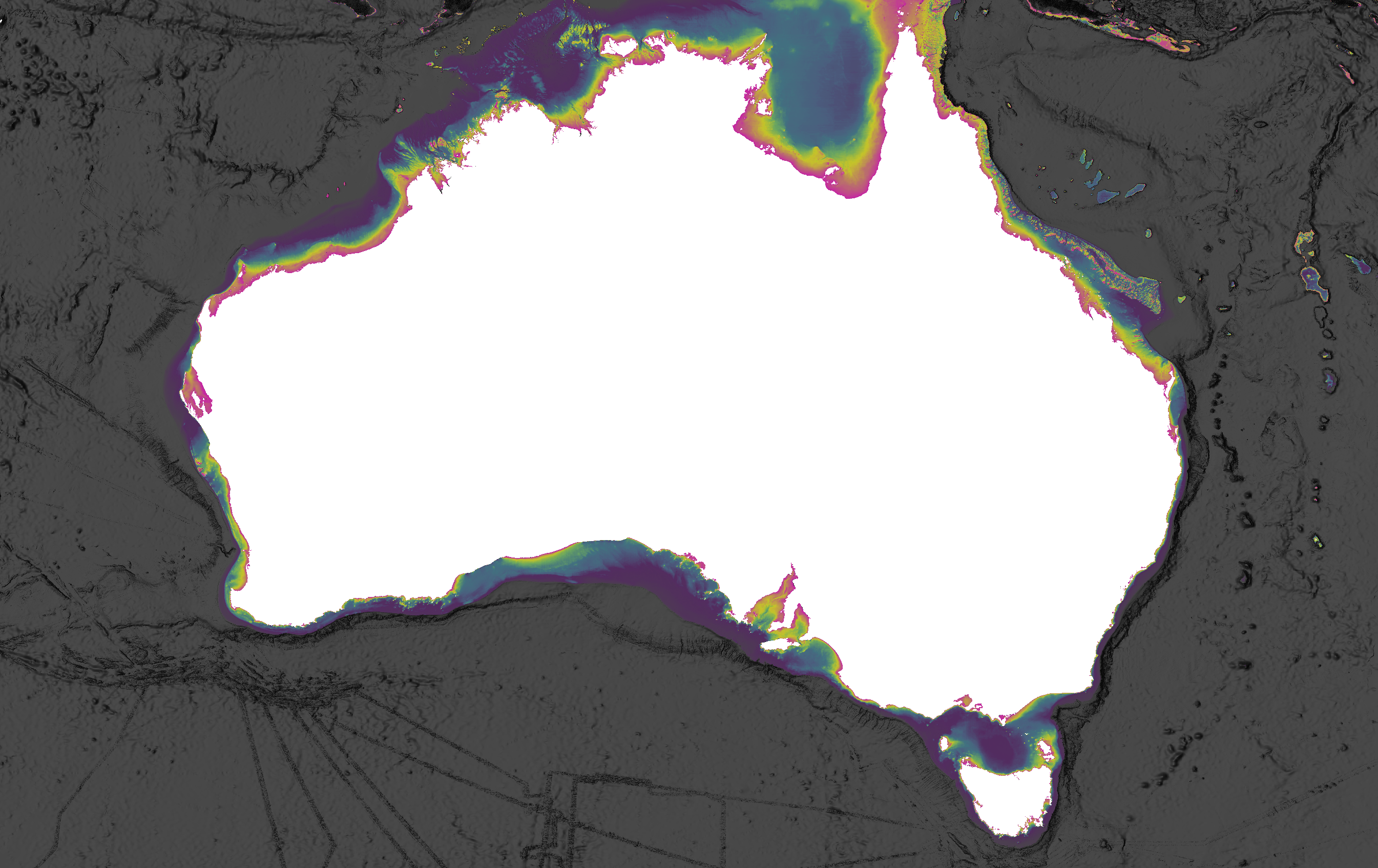
BathyMaps Coverage ©
BathyMaps Premium covers all Australian Waters.
Layer
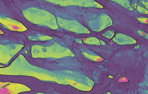
PaleoMaps layer ©
Designed for shallow-water fishing between 0 to 40m by highlighting depth changes in that depth range.
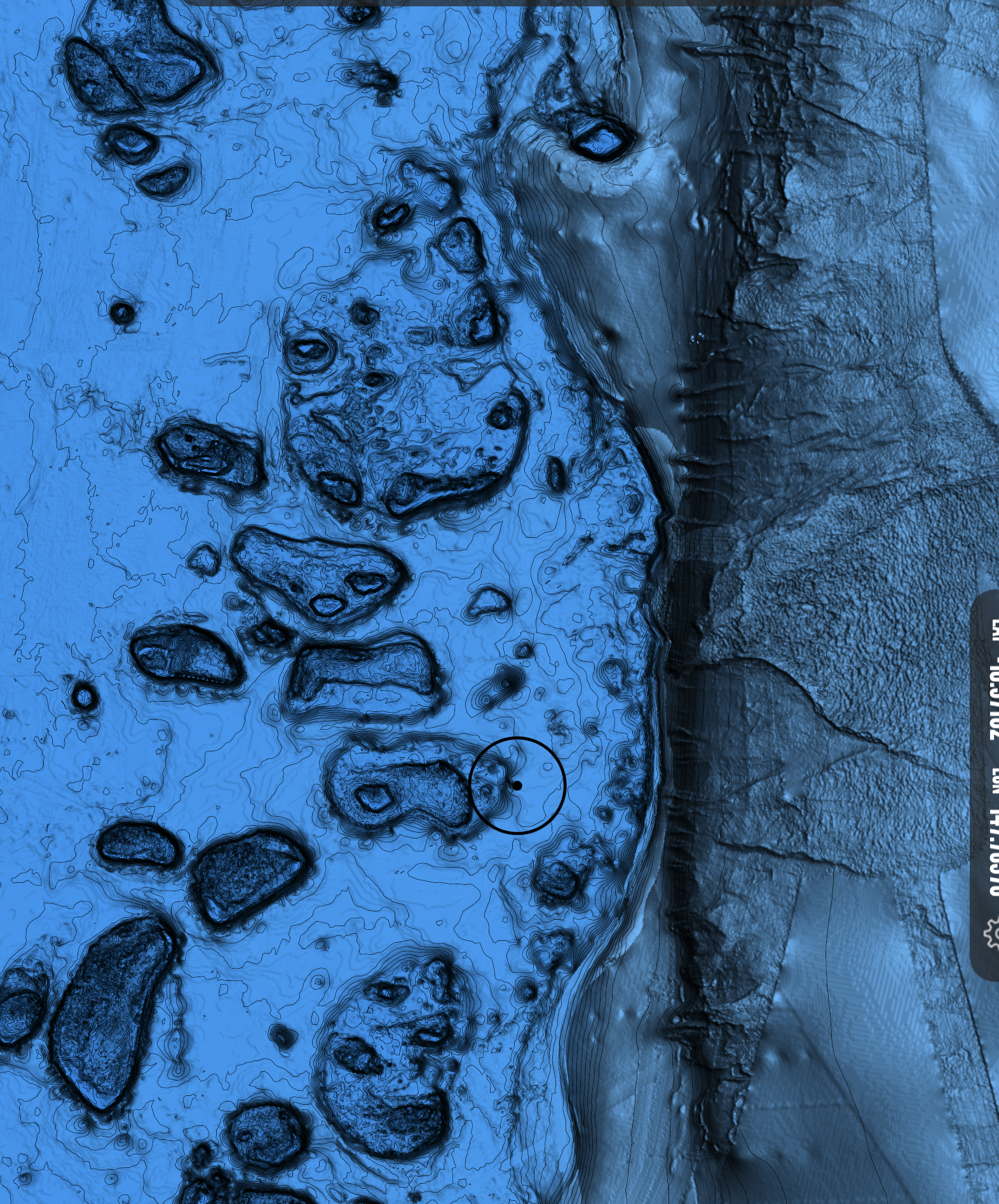
Layer
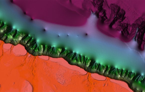
Deep layer ©
Designed for deep-water fishing between 100 to 1000m by highlighting depth changes in that depth range.
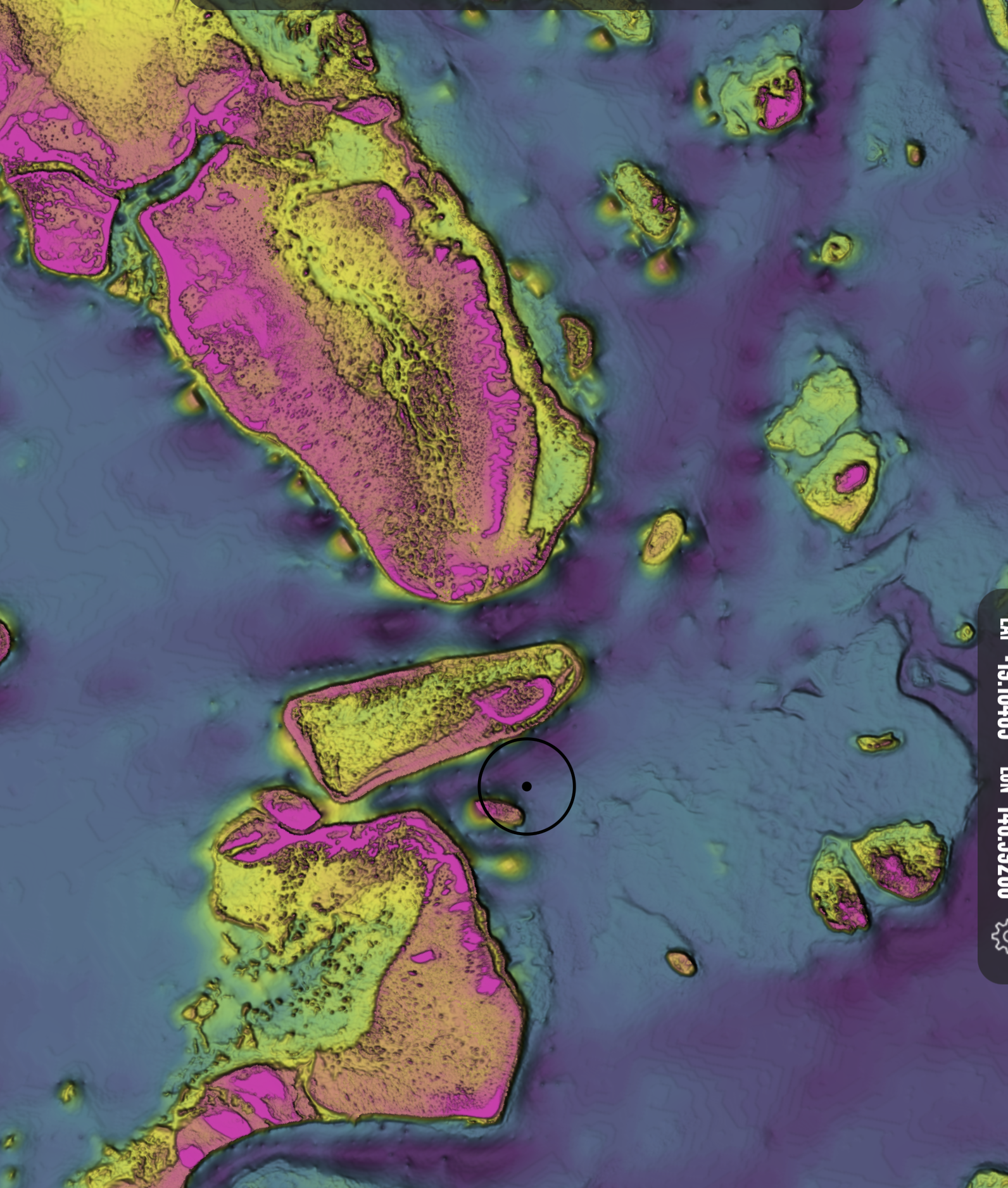
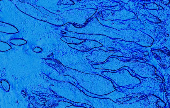
Layer
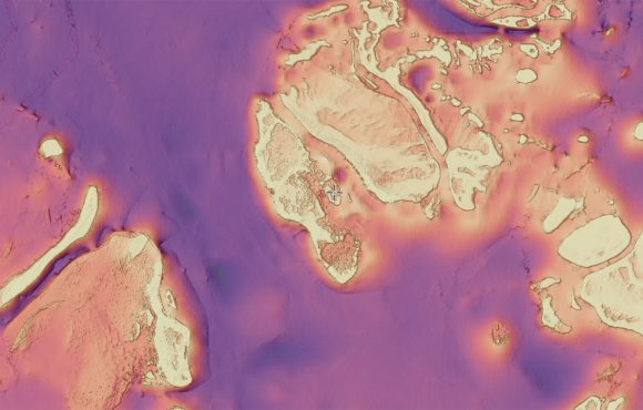
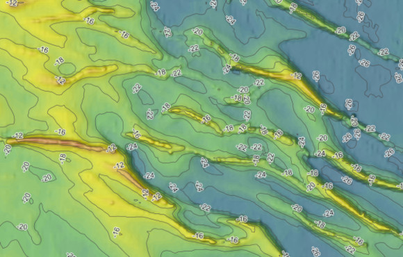
Magma layer ©
A great all-rounder for the general fisherman, providing clear, easy to interpret seabed mapping.
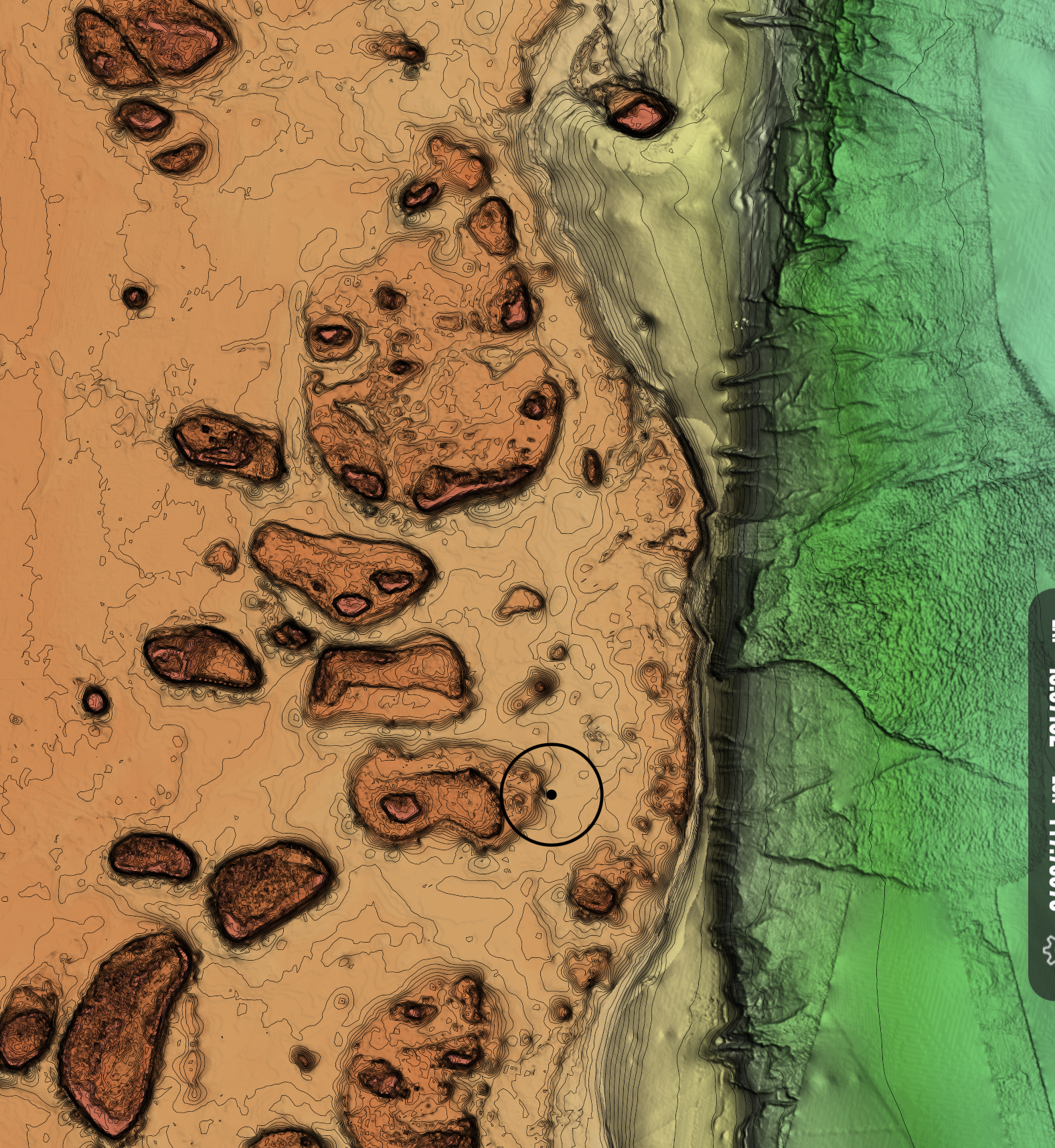
Original
BathyMaps ©
The Original. Maxed out contrast and depth for maximum depth change interpretation. Find those lumps.
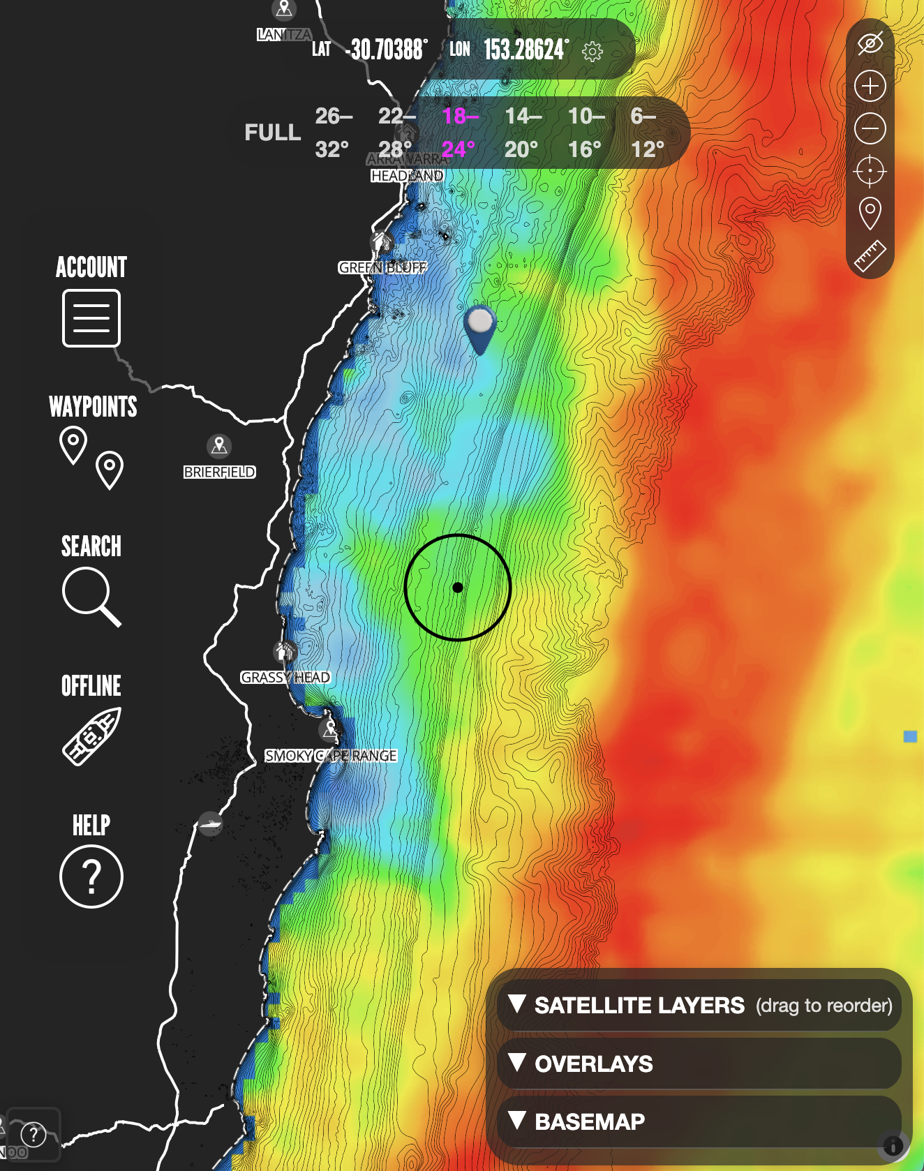
Overlay
SST Data
Real-time and hourly forecast sea surface temperature data from multiple sources.
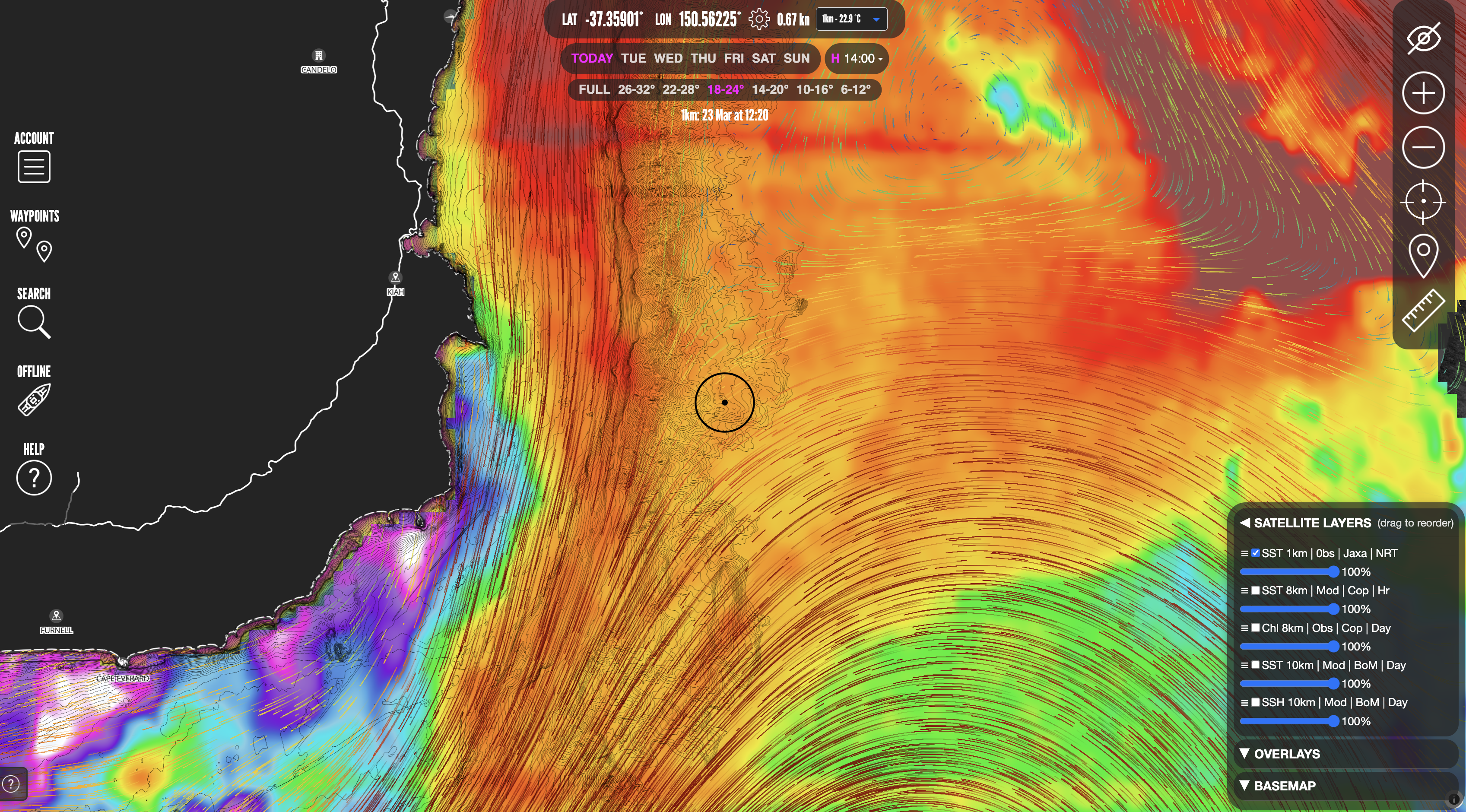
Overlay
Total Currents
Total Currents data, integrates ocean, tidal and wind currents to give you a complete picture of current conditions.
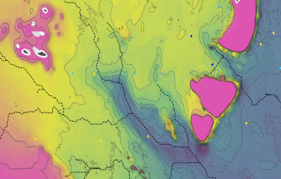
Overlay
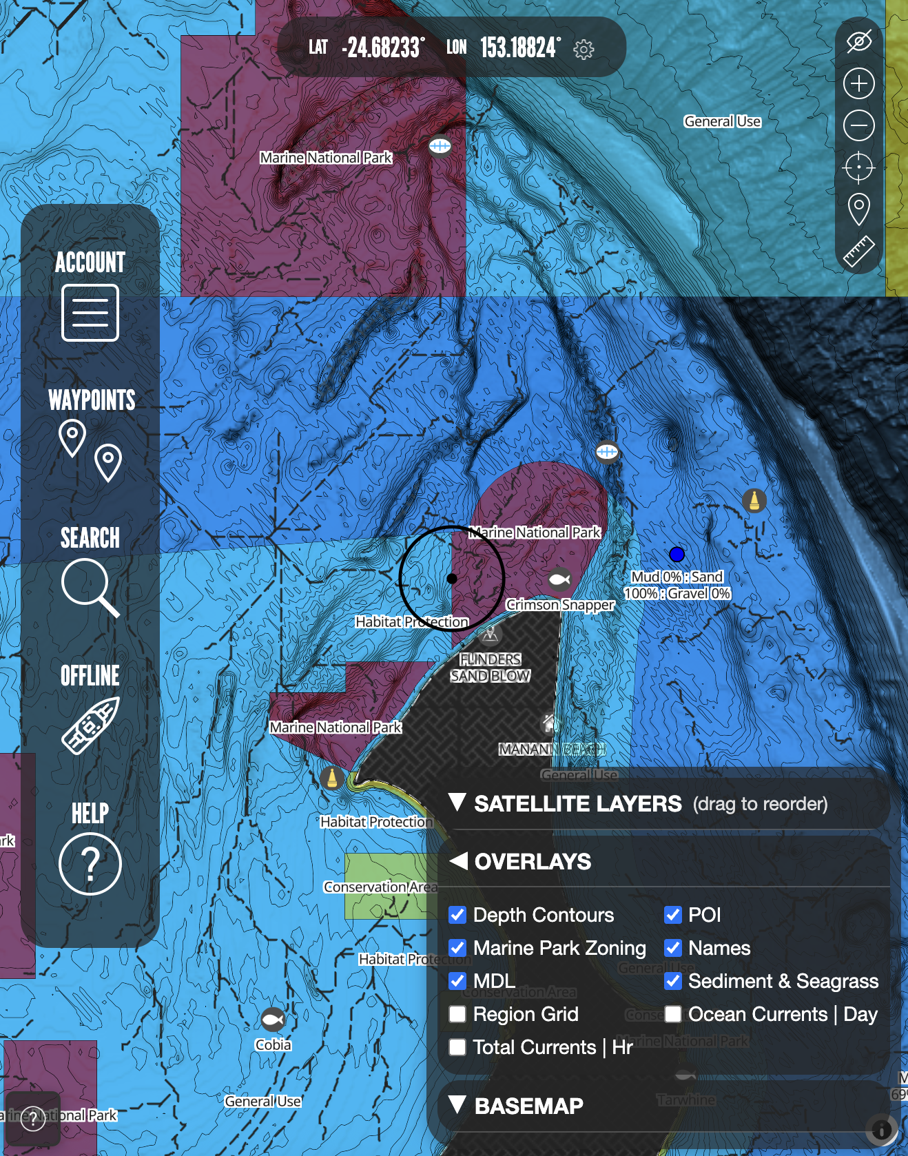
Wonky Hole overlay
Includes MDL and sediment data. Use with our bathymetry basemaps, to refine wonky hole search areas.
Overlay
Custom contours
Using the best available bathymetry data can guide your depth based fishing strategy.
Overlay
Custom zoning layers
Makes it super easy to know where you can and can't fish. Will keep you out of trouble.
Mobile
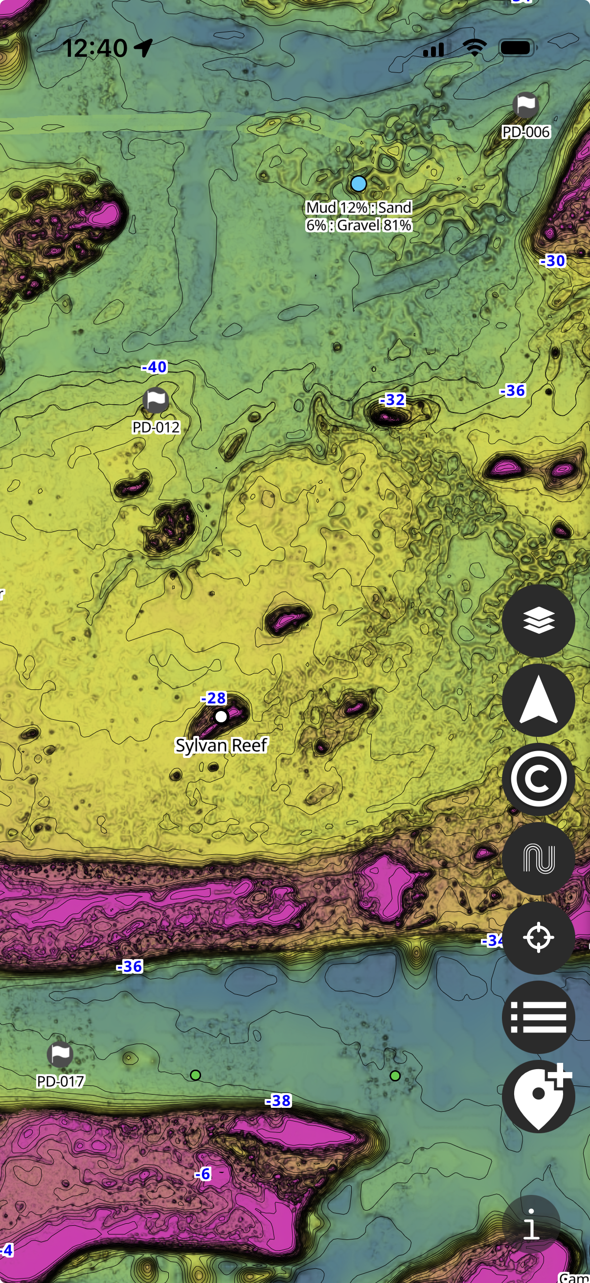
Offline Capabilities
Access to a dedicated offline app to use our maps at sea with no reception.
Subscription Options
Choose the BathyMaps Premium option that suits the way you fish.
Membership
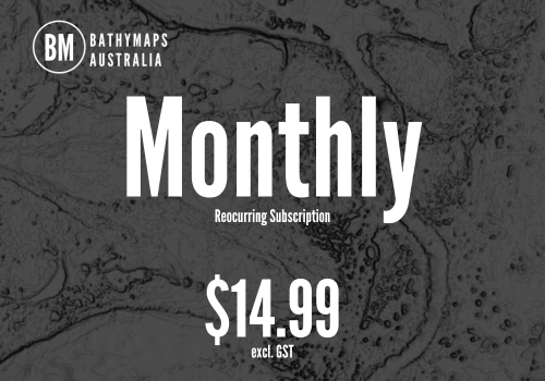
Monthly ©
The monthly subscription renews every month and can be cancelled at anytime.
Membership
Annual ©
Save 50% on the monthly subscription with the annual subscription, which renews annually and can be cancelled at anytime.
Demo
BathyMaps Demo
See how the BathyMaps experience looks in motion before heading into the premium workspace.
Guide
BathyMaps Premium PDF Guide
Browse the guide directly from the home page and keep the most important premium details in one place.
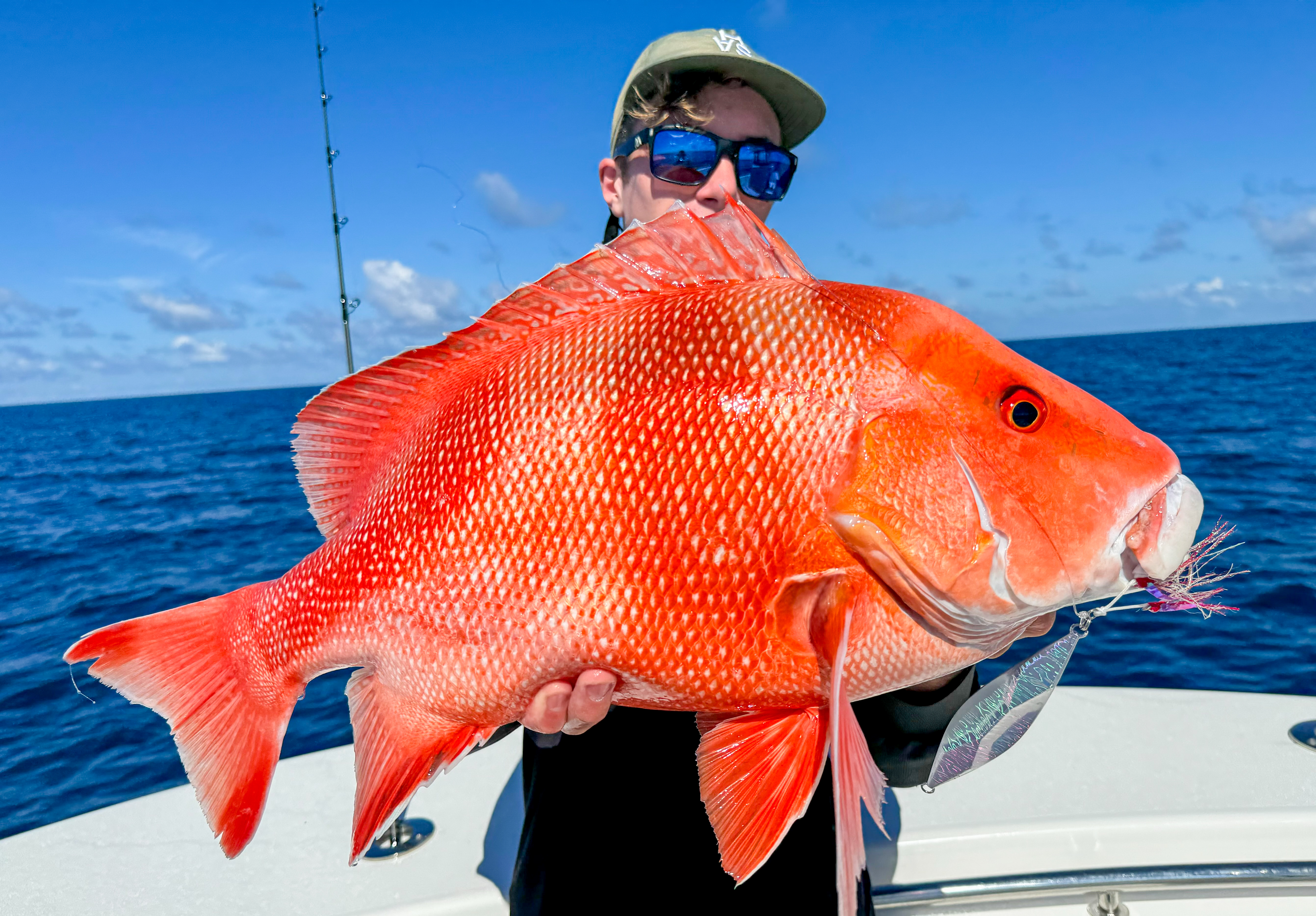
Community
BathyMaps Premium is trusted by thousands of Anglers across Australia.
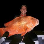
Premium User
Tyler
BathyMaps Premium in conjunction with a good sounder is what found these fish, 100%.
View on Instagram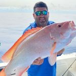
Premium User
Jason
So much to explore, so much to find, anticipation of fidning new ground is exciting thanks to BathyMaps Premium.
View on Instagram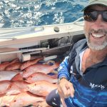
Premium User
Mick
I used BathyMaps Premium to find these new marks and got onto some nice nannys.
View on Instagram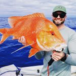
Premium User
Tom
Great for planning trips and finding fish holding structure.
Follow BathyMaps Australia on Instagram.
Stay close to the trips, catches and new ground the community is finding with BathyMaps Premium.